Tuesday, July 24, 2012

Hairy Butterworts & other fun field photographs


 Here is a random assortment of photos from the last couple of weeks in Healy. I have been pretty busy with field work but every now and then I remember to get the camera out. Enjoy!


Marchantia polymorpha, a liverwort living under the porch of our cabin


This squirrel lives near our cabin and has gotten quite bold- he like to break into our compost bucket and steal food scraps. Sometimes he swears at me from the trees as I make my way to the outhouse. 


Chocolate cookies made to celebrate a long week of point framing.


 The neighbors expressing their political views while adding a little decoration to their dog-poop pile


 Going, Going, Gone! 
These photographs all depict the same 60 x 60cm square of tundra. For my research this summer I am setting up some experimental plots in which all of the aboveground plant material is removed. I will be using these plots to better understand the role plants play in soil decomposition and nitrogen cycling.


 Pinguicula villosa, aka the Hairy butterwort!
This is a carnivorous plant that lives in mossy patches of the tundra. Small insects get trapped inside the leaves and are slowly digested. The leaves in this photo look a bit like a gaping maw, no?


The Hairy butterwort is a very small plant: there are two growing in this patch of Dicranum moss but they are overshadowed by the large Rubus chamaemorus (cloudberry) leaves.


 Vicious

Tuesday, July 10, 2012

Glaciers!

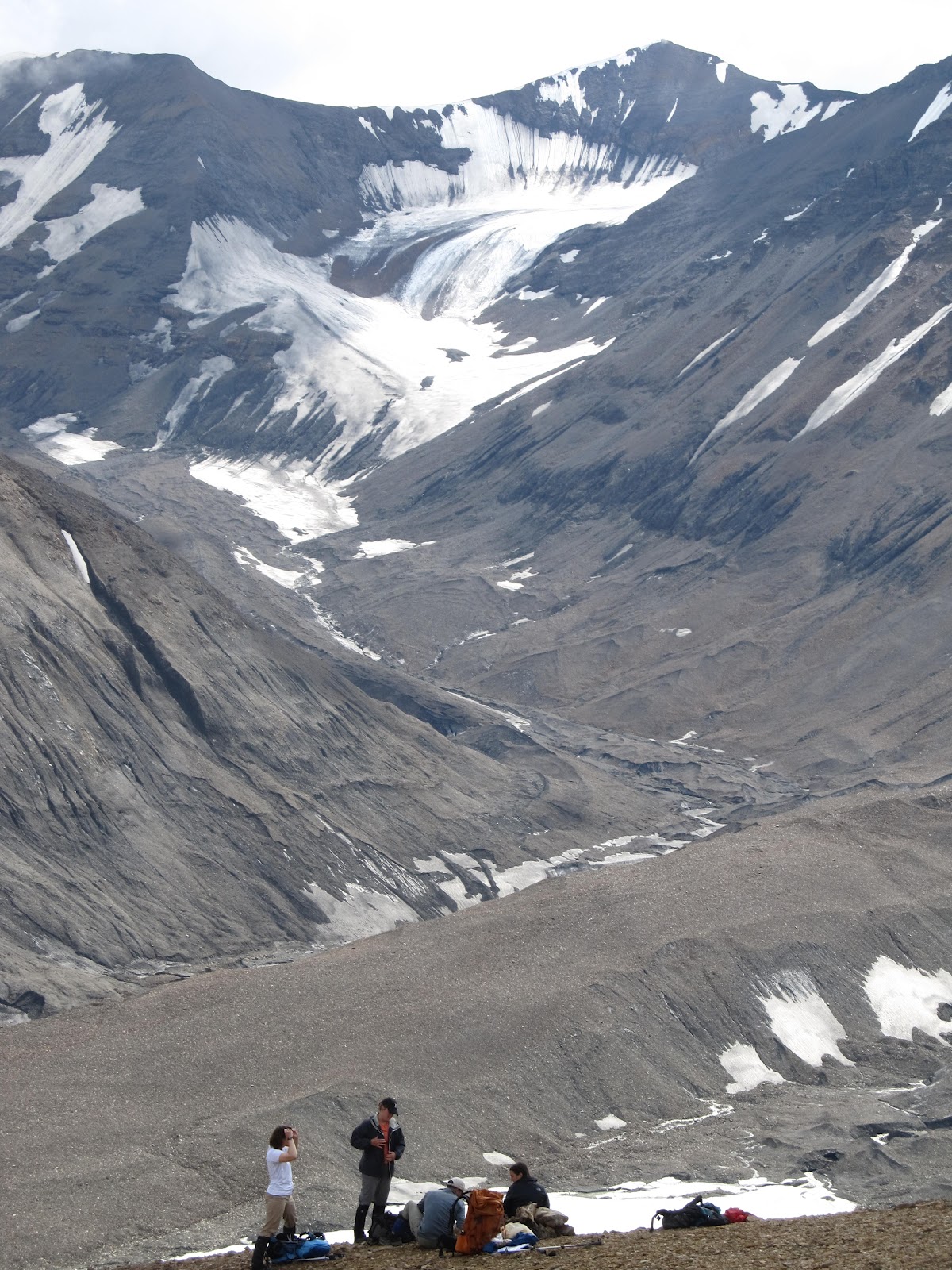
This last weekend my coworkers and I had an awesome opportunity to explore some glaciers in Denali National Park with the Park's Glaciologist Rob Burrows. We spent the weekend exploring the terminus of a glacier located on the East Fork of the Toklat River, about 10 miles from the Park Highway. Rob's goal for this trip was to scout out the area for a field course he will be leading there in a few weeks. We also took some photos and GPS points on and around the glacier. These will be compared to photos and GPS points taken taken ten years ago. 

Below is a link to a neat website where you can find modern and historic photographs of other glaciers in Denali National Park:


To get to the glacier in questions we spent most of Friday afternoon and evening hiking up is beautiful riverbed


Bearspray, check! We saw one grizzly bear on this hike but he was quite far away and was quite preoccupied with foraging.


 Night hiking never looked so good!


Glacier Terminus, finally visible around the last bend of the river


Caribou! This guy only had one antler and was looking a little shaggy


Glacial silt makes for some very pretty mud


On Saturday we hiked up this ridge to reach a GPS survey marker


Papaver radicatum, Arctic poppy


Patterned ridges in melting snowfield


Rocks, ice and snow with some afternoon light coming through the cloud cover


We found a part of a hill slope that was in the process of eroding away: the ice underneath the rocky debris used to be part of a small glacier but is now stationary. As the stationary ice melts the rocky debris slides downhill a large karst is left behind.


Short video showing the debris sliding away


We made it up onto the glacier on Saturday afternoon. Right around this time a storm moved in so unfortunately we could not stay for long. Nothing makes you feel vulnerable quite like standing on an open ice field when thunder claps overhead!


The view back down the river valley


When we awoke on Sunday morning we had some hail, rain, AND snow on our tent. The walk out was a bit cold but the snow covered mountains were beautiful.

Wednesday, June 27, 2012

Midnight Sun

Happy Solstice Everyone!


The clouds here in the summertime are pretty fantastic. The best part is it is never too dark to see 'em!


Mamma moose and some twins running in the Savage River in late May. You can tell it has taken me a while to post this photo (sorry folks!) because these days all the vegetation along the Savage is green.

My co-worker and fellow grad student Elizabeth fording the Sanctuary River during a backpacking trip we took last month.  Who needs dry socks?


The CiPEHR experiment on a particularly foggy morning. The solar panels usually generate enough power to keep the autochamber system running 24 hours a day. When we have a few cloudy days in a row, however, it is often necessary to give the batteries a hand with gas powered generators.


When a CO2 flux is being measured the doors on the top of the autochamber close and the gas from inside is pumped through the blue tubes to an infrared gas analyzer. These fluxes are taken at all hours of the day and averaged over time to tell us about overall  carbon balance of the ecosystem.


These are some anion and cation binding resins bags that I am installing in the CiPEHR plots as a way to look at the availability of inorganic nitrogen in the soil.


Chunk o'tundra I brought back to the lab. Sometime this year I want to try and decorate a chocolate cake to look like this... any co-chefs interested in participating?


Mt. Healy! I wish I could say this was the summit, but we didn't quite make it all the way to the top on this hike. A lazy morning and evening plans for a BBQ cut our journey short. Clearly too many fun things to do on our day off!


View from almost-the-top-of-Mt. Healy


Dryas octopetala flowering in Denali National Park


Marmot! This lil guy was enjoying a nap in the sun when we found him. He was perturbed, as you can probably tell from his expression.


Getting some deep soil cores with the gas powered auger. I can't believe how lucky... I get to do stuff like this and call it WORK!
Photo credit Dr. Sue Natali


I love my permafrost!
Photo credit Dr. Sue Natali


This is a section of the AK pipeline near Fairbanks. According to the Alyeska Pipeline Service Company's website, in 1988 the pipeline pumped an average of 2,033,082 barrels a day. In 2011 its average throughput was only 582,895 barrels per day.


Two weeks ago I got to go on a tour of the US Army Corps of Engineer's permafrost tunnel in Fairbanks. This tunnel was dug from 1963-1969 and is used as a research site for all sorts of permafrost research. The tunnel is not open to the general public but there is a neat virtual tour available here: http://permafrosttunnel.crrel.usace.army.mil/overview/virtual_tunnel_tour.html.  


This is the view as you enter the tunnel. The ceiling is lined with dangling frozen plant roots. At the end of the tunnel (110 m long, 15m below the surface) the permafrost is 40,000 years old.


Ice lenses, small and large! The cylindrical holes are from where samples have been take in the past. The permafrost below the large, horizontal ice lens is lined with what looks like scratch marks: these are actually lots of tiny "reticulate-chaotic" ice lenses. They form in areas where the permafrost has thawed and refrozen while surrounded by continually frozen permafrost


The ice wedge I am illuminating was formed when a crack developed in the soil during the normal seasonal freeze-thaw cycle. This crack was progressively widened as water entered the crack, froze and expanded. There is a nice diagram describing this process here: http://permafrosttunnel.crrel.usace.army.mil/permafrost/massive_ice.html


Different depositional layers in the permafrost


This wheelbarrow and some pretty cool icy stalagmites were located near the entrance of the tunnel. Sadly it was too cold in the tunnel to stay long!


This week I installed some cores that will help me estimate rates of nitrogen mineralization. This core is ready to be incubated for the season underneath a nice mossy blanket.


Though I can't brew beer up here in AK I still have time to play with some yeasty beasties. This loaf of bread came out looking particularly tasty!